Tortolì
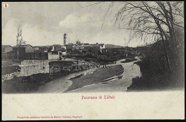
The town of Tortolì is in the historical-geographical region of Ogliastra, on the central-eastern coast of Sardinia (figs. 1-2). Its territory, extending about 40 km2 from the hills surrounding it to the West to the sea to the East, is a fertile plain originating from the alluvial deposits of the rio Foddeddu and rio Sa Teula.
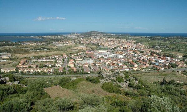
Due to a growth in population in the second half of the XX century, the town now has about 11,000 inhabitants. Of particular importance, the port in the marine district of Arbatax and the airport (fig. 3).

Tradition has it that, around the year 1000, Tortolì stood where the country church dedicated to San Lussorio stands today, near the sea. This area is said to have been abandoned because of Arab raids, to then build the village on its current site. The find, in 1970 in the area of S. Lussorio, of stone blocks worked belonging to residential structures seems to confirm the truth of this tradition.
The first documents providing information on the story of Tortolì date to the period when Pisa dominated the eastern coasts of Sardinia (1316). They hand down a list of heads of families registered to pay taxes to the Municipality of Pisa. After 1323, when the Aragonese conquered Sardinia, Ogliastra came under the control of the Carroz, counts of Quirra, and Tortolì became the chief town of the curatoria (political-administrative division that started in the Giudicati period).
During Spanish domination, in particular between the end of the XVI and the first decades of the XVII century, they built lookout and defence towers to prevent attempts made by the Arabs to land on the Ogliastra coasts. Three were built in the territory of Tortolì: San Miguel, San Gemiliano and Largavista (demolished in 1866 to build the Bellavista lighthouse).
In 1807, under the reign of Vittorio Emanuele I, Tortolì became the provincial capital , and in 1824 the seat of the Diocese of Ogliastra. In 1927, Tortolì and Ogliastra became part of the province of Nuoro, now the capital. During World War II, in 1943, the port of Arbatax was bombed causing death and destruction.
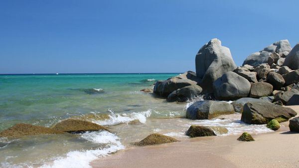
Today, both Tortolì and Lanusei are capitals of the province of Ogliastra. Its economy is not only based on agriculture, fishing and crafts; but also on some industries linked to oil shipbuilding and the tourist accommodation sector (fig. 4).
Bibliografia
- A. LEPORI, Tortolì e la sua gente attraverso i secoli, Dolianova 2005.
- V. NONNIS, Tortolì, in Ogliastra. Antica Cultura – Nuova Provincia. I Paesi, Sestu-Bari Sardo 2005, pp. 143-153.
- V. NONNIS, Tortolì e dintorni, Cagliari 1994.
- A. LEPORI, Tortolì: la sua storia, il suo mare, Cagliari 1991.
- A. LEPORI, P. ZUCCA, La diocesi d'Ogliastra nelle sue sedi di Tortolì e Lanusei, Dolianova 2004.
- V. NONNIS, Storia e storie di Tortolì, Cagliari 1988.
- G. DEIANA, La Diocesi di Ogliastra (1758 - 1834): trattative ed erezione della diocesi, Roma 1979.
 VR
VR