The territory in the Roman Period
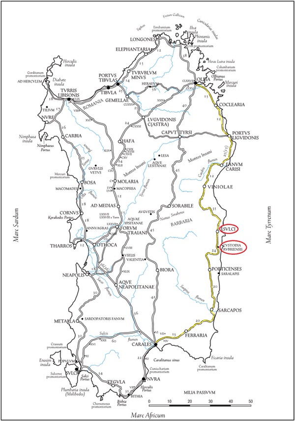
During the Roman Period, Ogliastra was not only a nodal point between north and south Sardinia, on the road connecting Carales and Olbia, but also connected the island's inland area with the eastern coast (fig. 1).
In the Ogliastra region, in this period of its history, there was a strong military presence , proven by the name of the centre of Custodia Rubriensis (located at Bari Sardo) and finding, between Lanusei and Ilbono, of diplomas (probably all of classiari) and military decorations (phalerae). This proves that Roman veterans lived in the area despite its low Romanisation level.
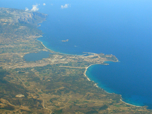
Information on the kind of settlements, probably mainly rural, is limited. But in some areas, like the coastal plan of the Tortolì pond, you have a concentration of evidence on the material culture dating to the Roman Age (fig.2). Settlements of a certain size were identified to the north, on the plains behind the lagoon, like in the locations Tradala and Perdixedda; while further south, a particularly interesting site is at Is Murdegus.
In this historical period it is plausible that Roman ships sailing the Mediterranean towards North Africa had a stopping point along the coast of Tortolì-Arbatax. This assumption is confirmed by the numerous underwater finds made along the eastern coast of Sardinia, from Olbia to Cagliari. In particular, the wreck of a ship was found off Capo Bellavista-Arbatax. It carried ingots of tin, copper and iron from the mines in the Roman province of Betica (corresponding to the current Andalusia) and datable to the I century A.D.
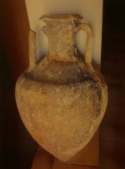
Other proof of the wall structures referable to Baths in the church of Santa Barbara and at San Lussorio and the numerous sporadic finds of coins, stamps on dolia and table and kitchenware. Furthermore, recovery at sea of a considerable number of amphorae (fig. 3) is evidence of intense trading, especially of oil and fish paste, between the Ogliastra coast and other Mediterranean countries, especially North Africa. This is also borne out by the mention found in ancient sources of the Sulpicius Portus (fig. 4). Its position can probably be placed on the coast of Tortolì-Arbatax, near the current pond area.

Bibliografia
- M.A. FADDA, Tortolì. I monumenti neolitici e il nuraghe S'Ortali 'e su Monte, Sardegna Archeologica. Guide e Itinerari, 49, Sassari 2012.
- G. CONSIGLIO, Il soldato romano: carriera militare e vita privata, in Ager Veleias, 5.07, 2010, pp. 1-29.
- A.A.V.V., Tesori riscoperti dalla terra e dal mare: la Guardia di Finanza in Sardegna, Catalogo della mostra (21 maggio-30 giugno 2005, Cagliari), Cagliari 2005.
- A. MASTINO, Storia della Sardegna antica, Nuoro 2005.
- V. NONNIS, Tortolì, in Ogliastra. Antica Cultura-Nuova Provincia, Sestu-Bari Sardo 2005, pp. 143-153.
- N. C. VELLA, La Geografia di Tolomeo e le rotte marittime mediterranee, in L. DE MARIA, R. TURCHETTI (a cura di), Rotte e porti del mediterraneo dopo la caduta dell’impero romano d’Occidente. Continuità e innovazioni tecnologiche e funzionali, Genova 2004, pp. 21-32.
- A. MASTINO, P. RUGGERI, La romanizzazione dell’Ogliastra, in MELONI, NOCCO 2001, pp. 151-190.
- M. G. MELONI, S. NOCCO (a cura di), Ogliastra: identità storica di una provincia, Atti del Convegno di Studi (Jerzu-Lanusei-Arzana-Tortolì 23-25 gennaio 1997), Senorbì 2001.
- P. MELONI, Bulgares o (servi) vulgares in Sardegna?, in L'Africa romana, XIII, Roma 2000, pp. 1695-1702.
- P. MELONI, La Sardegna romana, Sassari 1991.
- ARCHEO SYSTEM, Progetto I Nuraghi. Ricognizione archeologica in Ogliastra, Barbagia, Sarcidano. Il Territorio, Milano 1990, pp. 49-72.
- ARCHEO SYSTEM, Progetto I Nuraghi. Ricognizione archeologica in Ogliastra, Barbagia, Sarcidano. I Reperti, Milano 1990.
- A. PAUTASSO, Testimonianze di età romana, in ARCHEO SYSTEM 1990 a, pp. 124-128.
- F. COCCO, Dati relativi alla storia dei paesi della diocesi d’Ogliastra. Arzana, Baunei, Elini, Escalaplano, Esterzili, Gairo, Girasole, Jerzu, I, Cagliari 1987, pp. 238-241.
- F. LO SCHIAVO, P. GIANFROTTA, Un problema insoluto: il relitto di Capo Bellavista, in Bollettino d’Arte, Archeologia subacquea, 3, nn. 37-38, suppl., luglio 1987, pp. 135-139, Roma 1987.
- P. MELONI, La geografia della Sardegna in Tolomeo (Geogr. 3., 3, 1-8), in Nuovo Bullettino Archeologico Sardo, 1986, pp. 207-250.
- R.J. ROWLAND, Ritrovamenti romani in Sardegna, Roma 1981.
- I. DIDU, I centri abitati della Sardegna romana nell’Anonimo Ravennate e nella Tavola Peutigeriana , in Annali della Facoltà di Lettere e Filosofia di Cagliari, VII, Cagliari 1980-81, pp. 203-213.
- A. BONINU, Tortolì, località S. Lussorio (Nuoro), in Nuove testimonianze archeologiche della Sardegna centro-settentrionale, Sassari, 1976, pp. 105-106.
- S.M. CECCHINI, Ritrovamenti fenici e punici in Sardegna, Roma 1969.
- V. M. CANNAS, Tertenia e dintorni nella storia e nella tradizione, Cagliari 1963.
- E. PAIS, Storia della Sardegna e della Corsica durante il periodo romano, I-II, Roma 1923.
- G. SPANO, Scoperte archeologiche fattesi in Sardegna in tutto l’anno 1871 con appendice sugli oggetti sardi dell’esposizione italiana, Cagliari 1872.
- G. SPANO, Memoria sulla badia di Bonarcado e scoperte archeologiche fattesi nell'isola in tutto l'anno 1869, Cagliari, 1870, p. 30.
- E. PINDER, Itinerarium Antonini Augusti et Hierosolytanum, I, 1848, pp. 36-39.
- CLAUDII CLAUDIANI, Opera omnia, ex editione P. Burmanni secundi, Londini 1821.
 VR
VR