Savoy stronghold of Su Pisu
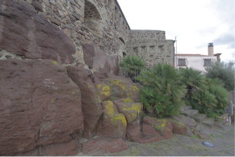
The Savoy stronghold of Su Pisu, also called "castle", is located in the highest place of the village of Sant' Antioco, on the so-called Mont'e Cresia, and is located in a strategic point, evidenced by the succession of buildings over the centuries. The oldest structure consists of a Nuraghic polylobate tower, probably built in the fifteenth century B.C. on the slope leading down to the necropolis of Is Pirixeddus, next to the remains of the Nuraghe where traces of the Nuraghic village were found (fig. 1).

The Nuraghe was demolished by the Carthaginians and a polygonal tower was built on its ruins, which probably served as a passage between the defensive walls that were erected during the first half of the fourth century B.C. In the immediate vicinity of the tower, in all likelihood, the monumental northern gate of the city once stood, with the statues of the two lions, today at the museum, which during the Roman Imperial period were placed to decorate the podium of the amphitheatre (fig. 2).

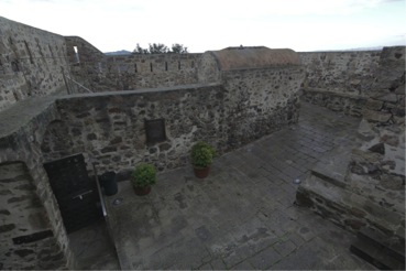
With the Roman conquest in 238 B.C., the Carthaginian fortifications were dismantled and reused for building a temple. Many centuries went by before another defensive structure was built on the hill, and this happened only when the island of Sant'Antioco, after a long period of neglect due to the continuous raids of the Saracens which had already started during the VIII century, began to be repopulated during the eighteenth century. The stronghold was designed and engineered in 1812 and was built over the previous Punic building which delimits the floor plan with its irregular shape; it was used for defence until 1815, when it suffered a final assault by the pirates of the Bey of Tunis. At the centre of the fort there is a small building with a strong structure, which must have been used as a powder magazine (figs. 3-4). The courtyard is almost entirely paved with stone blocks of basalt.


A sentry box with several loopholes protected the entrance where a drawbridge was probably placed in the original plan. There are walkways at several levels along the perimeter walls. The courtyard has an arched opening for the cannon which faces east, towards the sea, and other cannons are located along the perimeter of the fortress (figs. 5-6) where there are loopholes for the riflemen. Under the pavement in front of the entrance hall there is a cistern.


Bibliografia
- P. BARTOLONI, Il museo archeologico comunale “F. Barreca” di Sant’Antioco, Sassari 2007.
- P. BERNARDINI, I leoni di Sulci, Sardò 4, Sassari 1988.
- A. BOSCOLO, La Sardegna bizantina e alto-giudicale, Sassari 1982.
- G. MONTALDO, I forti piemontesi in Sardegna, Sassari 2003.
- S. MUSCUSO, La necropoli punica di Sulky, in M. GUIRGUIS, E. POMPIANU, A. UNALI (a cura di), Quaderni di Archeologia Sulcitana 1. Summer School di Archeologia Fenicio Punica (Atti 2011), Sassari 2012.
- G. RACHELI, L’arcipelago di Sulcis e la sua storia, Calasetta 1981.
- M. RASSU, Guida alle torri e forti costieri, Cagliari 2000.

 VR
VR