The nuraghe of S’Ortali ’e su Monte
In San Salvatore, not far from the sea and beaches of Orrì, you have the archaeological area of S’ortali ’e su Monte. This is a real monumental complex formed by domus de janas, menhirs, one nuraghe and two tombs of giants, extending over about 8000 mq on a granite hill dominating the nearly coastal plain.
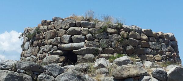
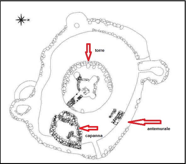
The nuraghe (fig. 1), with one tower and surrounded by an outer wall with three towers, stands 36 metres above sea level, in the higher part of the hill and is dated to the Middle Bronze Age (1500-1400 B.C.). In the outer wall, to the East, South and South-West, there were three entrances.

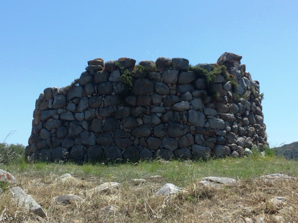
The central tower, only partly preserved for a height of 4.26 metres, has a South facing entrance and reuses a broken menhir belonging to the pre-nuragic period as a beam (figs. 2-3).
The tower entrance leads to a corridor with the remains of stairs leading to the terrace still visible on the left side. From this short passage you can enter the circular chamber, originally tholos vaulted, with three large niches dug into the thick wall (fig. 4). Recent archaeological digs performed in the chamber showed that the monument was also used in subsequent late Punic and Roman periods; in the Early Middle Ages, when no longer lived in, it was used for burials .
During the archaeological survey carried out in the tower, they found a deposit of 19 bronze axes with raised edges.
The inhabitants of the village built near the nuraghe were farmers and used the fertile surrounding plain to cultivate cereals, as can be seen by the presence of 12 brick silos, built in the northern part of the complex, between the end of the Bronze Age and the Early Iron Age (about 1200-900 B.C.). This was a real barn where the cereals were stored for the needs of the community and for external trade.

Bibliografia
- ARCHEO SYSTEM, Progetto “I Nuraghi”. Ricognizione archeologica in Ogliastra, Barbagia, Sarcidano. I Reperti, Milano 1990.
- M. FRAU, I.3.45, Nuraghe di S’Ortali ‘e su Monte, in Archeo System 1990, pp. 75-76.
- G. CABRAS, Tortolì (Nuoro). Località S’Ortali ’e su Monte. Il complesso nuragico, in Bollettino di Archeologia, 13-14 (1992), pp. 181-183.
- G. CABRAS, Tortolì. Il complesso di S’Ortali ’e Su Monte, in Bollettino di Archeologia, 43-45 (1997), pp. 69-75.
- M.A. FADDA, Tortolì. I monumenti neolitici e il nuraghe S’Ortali ‘e su Monte, Sardegna Archeologica. Guide e Itinerari, 49, Sassari 2012.
- C. NIEDDU, Complesso di San Salvatore, in Siti archeologici d’Ogliastra. Itinerari alla scoperta di siti prenuragici e nuragici nel territorio dei paesi dell’Ogliastra, Lanusei 2006, pp. 54-55.
 VR
VR