The territory in the Pre-Nuragic Age
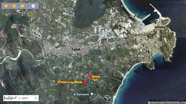
The plain of Tortolì-Arbatax, thanks to its favourable position near the sea, hence the possibility to farm, breed animals and fish, was conducive to human settlement in all ages (fig. 1).
The Neolithic Age (IV–III Millennium B.C.) was proven by menhirs (Orrì, Pèrd’e Fà, Sa Sèrra ’e Sa Pìra and by the bethel of Pèrd'e Fà) and by the numerous domus de janas dislocated in different parts of the area (San Salvatore; Monte Terli, Monte Attu, Cèa).
The zones with traces of Neolithic settlements are located in two environmental bands: a hilly one with granite hills like Monte Attu (81-99 metres above sea level) or lower like Monte Terli (30 metres a.s.l), S’Ortali ‘and Monte (26 metres a.s.l.), San Salvatore (30 metres a.s.l.), Perda Longa (20 metres a.s.l.) and Sa Serra ‘e sa Pira (57 metres a.s.l.); and a a coastal plain (Orrì).
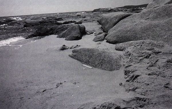
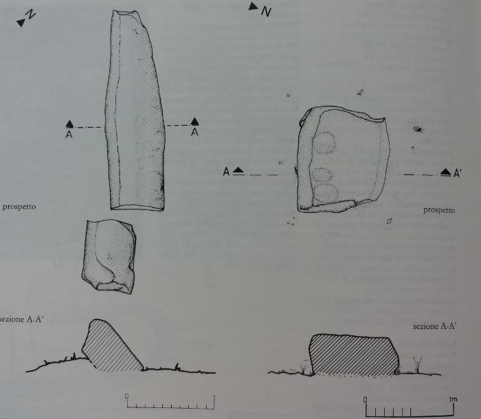
Of these communities we still have the tombs (domus de janas) and elements which can be connected to the so-called megalithic religion, such as menhirs (fig. 2), cup-shaped boulders, sacrificial stones, schematic petroglyphs (fig. 3). However, there are no remains from living quarters.

The archaeological complex of San Salvatore is structured around the country church of the same name and includes: two domus de janas, three aniconic menhirs and a cup-shaped boulder (fig. 4). Of the two domus, dug into a rocky granite spur, the former has been badly damaged by several collapses and its plan is not easy to read; the other, a few metres away, has a trapezoidal plant vestibule which leads to two longitudinal cells.
The underground necropolis of Monte Terli has eight domus de janas: four dug in isolated boulders on the west side and four on a wall with no easy access (fig. 5).

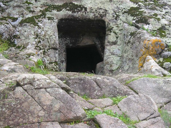
At S’Ortali ‘e su Monte, the archaeological area with the nuraghi and the tombs of giants also has a domus de janas (fig. 6) and some menhirs (fig. 7). The underground tomb, dug into the northern side of the hill, has a vestibule leading, through a hatch, into a pseudo-rectangular cell with a double niche.

Bibliografia
- M.A. FADDA, Tortolì. I monumenti neolitici e il nuraghe S'Ortali 'e su Monte, Sardegna Archeologica. Guide e Itinerari, 49, Sassari 2012.
- ARCHEO SYSTEM, Progetto I Nuraghi. Ricognizione archeologica in Ogliastra, Barbagia, Sarcidano. I Reperti, Milano 1990.
- A. LEPORI, Tortolì, la sua storia, il suo mare, Cagliari 1991.
- V. NONNIS, Tortolì, in Aa.Vv., Ogliastra. Antica Cultura-Nuova Provincia, Sestu-Bari Sardo 2005, pp. 143-153.
 VR
VR