The village and the Su Zubu
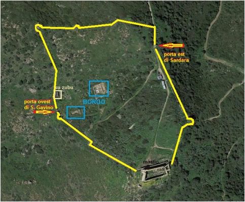
The village of the fortified complex was built on part of the two elevations which form the hill of Monreale and the valley between them, enclosed within a circle of walls with a sub-pentagonal plant (fig. 1).
These walls, about 950 metres long and still visible on the ground, were reinforced by the presence of eight (or maybe nine) semi-circular or square towers, which surrounded the town and then re-joined the keep.
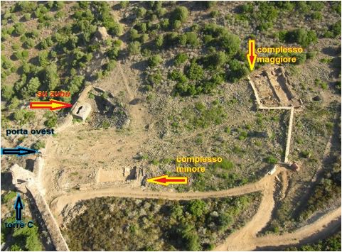
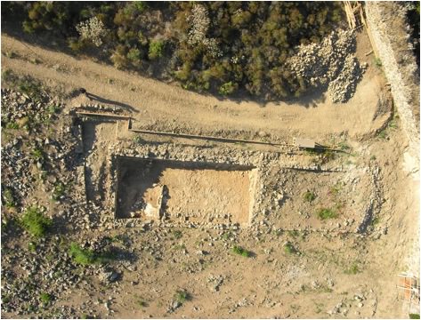
The archaeological investigations carried out over the years in the area of the village have highlighted two residential complexes divided into several spaces placed in sequence (fig. 2).
The building techniques and materials used to construct these dwellings show that they were all constructed at a single point in time.
Within the stratigraphy of the buildings, between the floors and the roof collapse, fragments of ceramics (archaic majolica) dating from the late thirteenth century have been recovered.
This discovery demonstrates the existence of the village in a period prior to 1309, i.e. the year reported in the first document which mentions the castle .
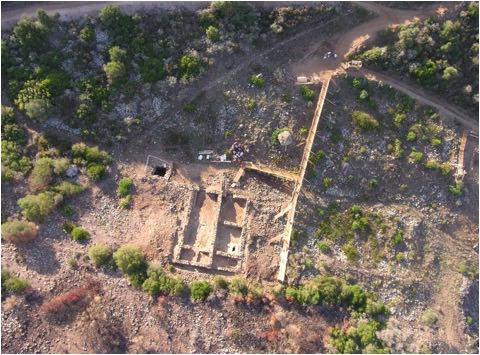
It is therefore likely that the design of the fortified complex already included a stable built-up area in its earliest stages. The first of the two residential complexes (the larger one) is characterised by the presence of five rooms, connected by stairs, as they are arranged at different heights along the hill slope (fig. 3).
One of these rooms was the entrance to the whole complex and was probably intended to host craft activities of various kinds (fig. 4).
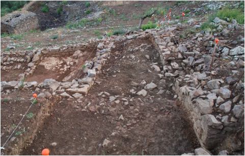
The second housing complex (the smaller one) consists of three spaces which could be accessed through a south-facing entrance, while the North side shows an opening identifiable with a window (fig. 5).
On this side, the room was sheltered from exposure to the winds thanks to the rocky bank which was located at a higher level than the floor of the rooms.
The entrance to the room is characterised by the presence of an area dedicated to food preparation and cooking.
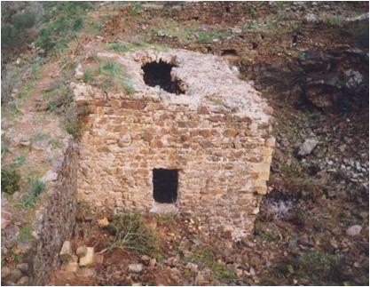
Near the West gate of the village, called "San Gavino", there is a structure called Su Zubu.
This is a quadrangular space, built in masonry, placed inside the fortified walls (fig. 6). During the first half of the nineteenth century it was cited by the historian Vittorio Angius who called it "[...] a square basin where apparently rainwater was collected".
Modern investigations have not clarified the intended use of the basin, although the most likely hypothesis is precisely the one which considers it as part of a system for collecting and storing water intended for the inhabitants of the village.
Bibliografia
- F. STASOLLA, Per un’archeologia dei castelli in Sardegna: il castrum di Monreale a Sardara (VS), in Temporis Signa, V, 2010, pp. 39-54.
- G. UCCHEDDU, Le strutture murarie del castello di Monreale (Sardara-VS): uno studio tipologico, in V. GRIECO, I catalani e il castelliere sardo. Atti degli incontri sui castelli in Sardegna (2003) dell’Arxiu de tradicions, Oristano 2004, pp. 181-240.
- V SALAVERT Y ROCA, Çerdena y la expansiòn mediterrànea de la Corona de Aragòn, Madrid 1959, doc. n. 392, pp. 506-510.
- V. ANGIUS, s.v. Sardara, in Dizionario geografico, storico, statistico, commerciale dagli Stati di S. M. il Re di Sardegna, vol. XVIII, 1853, pp. 893-907.
 VR
VR