Port and coastal towers of Arbatax
- Modern Age, XVI-XVII century A.D.
The modern town of Arbatax is located in the centre of the east coast of Sardinia, at a point where the shoreline is full of headlands and inlets, near Capo Bellavista and the Stagno of Tortolì, in an area that has always been highly conducive to human settlement (fig. 1).

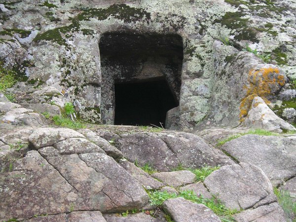
The oldest cultural stages date back to the Neolithic Age, proved by the presence in the area of several underground tombs, like the domus de janas and menhirs in the San Salvatore-S’Ortali ‘e su Monte (figs. 2-3) archaeological complex.

The Nuragic Age was full of nuraghi, both simple and polylobate and some burial sites, like those of S’Ortali ‘e su Monte (figs. 4-5).


Proof of the presence of the Phoenician-Punic people in the Tortolì area can be found in items found, in some ancient literary sources of a later date, telling of the presence of a port in the central part of the eastern Sardinian coast. This port, placed by scholars in the area of the current coastal pond of Tortolì, was an important stopping point for trading routes, in the Phoenician-Punic and Roman period, leading towards the central-western coast of Italy and North Africa (fig. 6).

During Roman times, the Olgiastra region, crossed by the road connecting Carales and Olbia, had a strong military connotation as the finds of diplomas and military decorations prove, indicating the presence of Roman veterans. Information on the kind of settlements, probably mainly rural, is limited. But in some area, like the coastal plan of the Tortolì pond, you have a concentration of evidence of the material culture dating to the Roman Age. The presence of a safe harbour for Roman ships sailing the Mediterranean, in Arbatax, is also confirmed by the numerous underwater finds in adjacent waters.
That type of coastline, with all the headlands and inlets, meant it was still exploited at later dates as a safe harbour and a lookout point to identify possible dangers coming from the sea.
In fact, from the first years of the VIII century A.D., the Arabs began to raid the Sardinian coasts, making construction of the first coastal defence towers necessary.
From the IX to the XV century, during the Sardinian Giudicati period, several forts were built to control the Sardinian coastline. During the island's Spanish dominion, in particular at the beginning and all through the first half of the XVI century, incursions increased considerably. So from 1570 they started planning a fort network to defend the coast. In 1587, King Philip II of Spain set up the "Royal Administration of Towers", entrusting it with the construction of new towers and their management, enrolling soldiers and supplying them with weapons. The pirate phenomenon stopped at the start of the XIX century so the coastal towers were no longer needed.
In general, the towers were positioned at strategic points from where you could cover wide stretches of sea and each tower could communicate, by luminous signals, with the ones next to it.
Between the XVI and XVII century, three lookout towers to defend and protect the territory against pirate raids were built in Arbatax. The towers of San Miguel and San Gemiliano are still visible, whilst the third one, called “di Largavista” was demolished in the second half of the XIX century to make room for the Bellavista Lighthouse.
The tower of San Miguel, originally indicated in Arabic as “Arba a Tasciar”, the “fourteenth tower”, is said to have given its name to Arbatax which grew, over the years, right around it. The imposing structure, built in the mid XVI century with granite and porphyry blocks, is 15 metres tall, cone-shaped and is split into two interior levels, linked by stairs inside the walls.
The tower guarding the harbour had canons and mortars. It was subjected to several attacks and attempts to land over the centuries. In 1846, they stopped using the building for lookout and defence purposes and it became a Tax Police barracks.


The tower of San Gemiliano, built in 1587, was originally called “Taratasciar” in Arabic, the “thirteenth tower”. In the XVII century, it was named the tower of Zacurru and only acquired its current name in 1767. It stands 43 metres above sea level, on a small headland guarding the bay of Porto Frailis, at about 4 Km from Tortolì. You have a view of over 25 km from the building.

Built with local granite blocks, cone-shaped and slender in structure giving it a diameter of 7 m and a remaining height of 12 m. The raised entrance, at about 4 metres up to guarantee the building better defence, could be reached by a rope or wooden ladder.
The space the guards lived in was a small room covered by a dome measuring about 13 mq, with two gun slits. Going up wooden stairs, through a trap door, you reached the terrace holding canons and where soldiers were protected behind a wall (that is a brick parapet present only on one side of the tower towards land). The tower was assigned an alcaide, that is a captain, two soldiers and an arsenal with six rifles, a cannon and two mortars. It was abandoned a few later after the Royal Administration of Towers was suppressed in 1842.
The third tower, called “di Largavista” was built before 1639 on the top of the headland and was demolished in 1866 to make room for the Lighthouse of Bellavista. The tower's name came from the fact that from its position you had an ample view of over 45 km from the coast.

Bibliografia
- M.A. FADDA, Tortolì. I monumenti neolitici e il nuraghe S'Ortali 'e su Monte, Sardegna Archeologica. Guide e Itinerari, 49, Sassari 2012.
- ARCHEO SYSTEM, Progetto I Nuraghi. Ricognizione archeologica in Ogliastra, Barbagia, Sarcidano. Il Territorio, Milano 1990, pp. 49-72.
- ARCHEO SYSTEM, Progetto I Nuraghi. Ricognizione archeologica in Ogliastra, Barbagia, Sarcidano. I Reperti, Milano 1990.
- A. LEPORI, Tortolì, la sua storia, il suo mare, Cagliari 1991.
- V. NONNIS, Tortolì, in AA.VV., Ogliastra. Antica Cultura-Nuova Provincia, Sestu-Bari Sardo 2005, pp. 143-153.
- M. FRAU, I.3.45, Nuraghe di S’Ortali ‘e su Monte, IN ARCHEO SYSTEM 1990, pp. 75-76.
- A. LEPORI, Tortolì, la sua storia, il suo mare, Cagliari 1991.
- G. CABRAS, Tortolì (Nuoro). Località S’Ortali ’e su Monte. Il complesso nuragico, in Bollettino di Archeologia, 13-14 (1992), pp. 181-183.
- G. CABRAS, Tortolì. Il complesso di S’Ortali ’e Su Monte, in Bollettino di Archeologia, 43-45 (1997), pp. 69-75.
- C. NIEDDU, Complesso di San Salvatore, in Siti archeologici d’Ogliastra, 2006, pp. 54-55.
- G. CONSIGLIO, Il soldato romano: carriera militare e vita privata, in Ager Veleias, 5.07, 2010, pp. 1-29.
- A.A.V.V., Tesori riscoperti dalla terra e dal mare: la Guardia di Finanza in Sardegna, Catalogo della mostra (21 maggio-30 giugno 2005, Cagliari), Cagliari 2005.
- A. MASTINO, Storia della Sardegna antica, Nuoro 2005.
- V. NONNIS, Tortolì, in Ogliastra. Antica Cultura-Nuova Provincia, Sestu-Bari Sardo 2005, pp. 143-153.
- N. C. VELLA, La Geografia di Tolomeo e le rotte marittime mediterranee, in L. DE MARIA, R. TURCHETTI (A CURA DI), Rotte e porti del mediterraneo dopo la caduta dell’impero romano d’Occidente. Continuità e innovazioni tecnologiche e funzionali, Genova 2004, pp. 21-32.
- A. MASTINO, P. RUGGERI, La romanizzazione dell’Ogliastra, in MELONI, NOCCO 2001, pp. 151-190.
- M. G. MELONI, S. NOCCO (a cura di), Ogliastra: identità storica di una provincia, Atti del Convegno di Studi (Jerzu-Lanusei-Arzana-Tortolì 23-25 gennaio 1997), Senorbì 2001.
- P. MELONI, Bulgares o (servi) vulgares in Sardegna?, in L'Africa romana, XIII, Roma 2000, pp. 1695-1702.
- P. MELONI, La Sardegna romana, Sassari 1991.
- ARCHEO SYSTEM, Progetto I Nuraghi. Ricognizione archeolo-gica in Ogliastra, Barbagia, Sarcidano. Il Territorio, Milano 1990, pp. 49-72.
- ARCHEO SYSTEM, Progetto I Nuraghi. Ricognizione archeolo-gica in Ogliastra, Barbagia, Sarcidano. I Reperti, Milano 1990.
- A. PAUTASSO, Testimonianze di età romana, in ARCHEO SYSTEM 1990 A, pp. 124-128.
- F. COCCO, Dati relativi alla storia dei paesi della diocesi d’Ogliastra. Arza-na, Baunei, Elini, Escalaplano, Esterzili, Gairo, Girasole, Jerzu, I, Cagliari 1987, pp. 238-241.
- F. LO SCHIAVO, P. GIANFROTTA, Un problema insoluto: il relitto di Capo Bellavista, in Bollettino d’Arte, Archeologia subacquea, 3, nn. 37-38, suppl., luglio 1987, pp. 135-139, Roma 1987.
- P. MELONI, La geografia della Sardegna in Tolomeo (Geogr. 3., 3, 1-8), in Nuovo Bullettino Archeologico Sardo, 1986, pp. 207-250.
- R.J. ROWLAND, Ritrovamenti romani in Sardegna, Roma 1981.
- I. DIDU, I centri abitati della Sardegna romana nell’Anonimo Ravennate e nella Tavola Peutigeriana , in Annali della Facoltà di Lettere e Filosofia di Cagliari, VII, Cagliari 1980-81, pp. 203-213.
- A. BONINU, Tortolì, località S. Lussorio (Nuoro), in Nuove testimonianze archeologiche della Sardegna centro-settentrionale, Sassari, 1976, pp. 105-106.
- S.M. CECCHINI, Ritrovamenti fenici e punici in Sardegna, Roma 1969.
- V. M. CANNAS, Tertenia e dintorni nella storia e nella tradizione, Cagliari 1963.
- E. PAIS, Storia della Sardegna e della Corsica durante il periodo romano, I-II, Roma 1923.
- G. SPANO, Scoperte archeologiche fattesi in Sardegna in tutto l’anno 1871 con appendice sugli oggetti sardi dell’esposizione italiana, Cagliari 1872.
- G. SPANO, Memoria sulla badia di Bonarcado e scoperte archeologi-che fattesi nell'isola in tutto l'anno 1869, Cagliari, 1870, p. 30.
- E. PINDER, Itinerarium Antonini Augusti et Hierosolytanum, I, 1848, pp. 36-39.
- CLAUDII CLAUDIANI, Opera omnia, ex editione P. Burmanni secundi, Londini 1821.
- G.P. TORE, Il Tercio de Cerdena (1565-1568), Pisa 2006.
- M. RASSU, Sentinelle del mare. Le torri della difesa costiera della Sardegna, Dolianova 2005.
- G. MONTALDO, Le torri costiere della Sardegna, Sassari 1992.
- F. FOIS, Torri spagnole e forti piemontesi in Sardegna, Cagliari 1981.
- E. PILLOSU, Le torri litoranee in Sardegna, Cagliari, 1957.
- A. DELLA MARMORA, Proposta per il riordinamento delle tor-ri di Sardegna e di un nuovo servizio costale per quell’isola, Torino, 1849.
- ANONIMO, Della costruzione e mantenimento delle torri del Regno di Sardegna, 1738.
- ASSOCIAZIONE SICUTERAT, Museo delle Torri e dei Castelli della Sardegna. Collezione Monagheddu Cannas, Sassari 2003.
 VR
VR