Roman Tharros
The Roman city of Tharros can currently be seen in its format during the Rome Empire era. Like all multi-strata sites dug decades ago without a stratigraphic criterion, is is now rather difficult to reconstruct the various phases of the site’s building activity, only being possible to date some of the better preserved buildings.
We can however reconstruct the general urban layout, that stayed unchanged for several centuries.
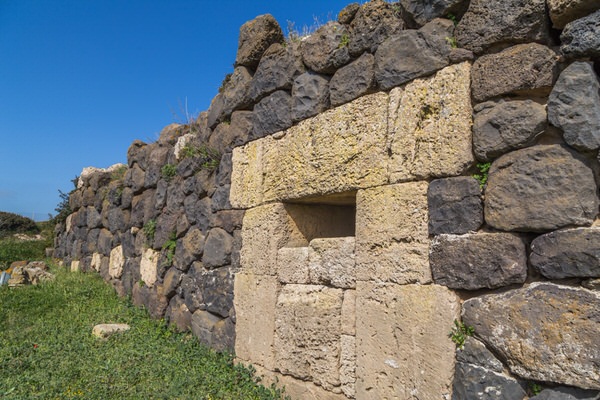
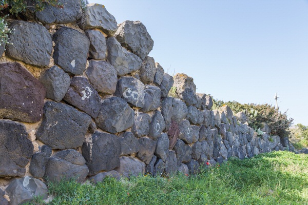
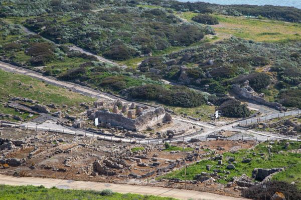
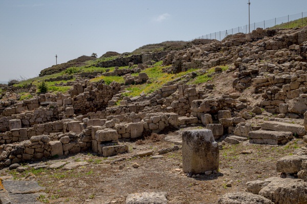
The first evidence of the Republic era city (2nd century B.C.) is the northern perimeter walls, slightly moved compared to the previous Punic ones (figs. 1-3). The walls surround the top of Su Muru Mannu, forming a moat together with the counterpoised counterscarp wall, which was partly filled in a century after being built and which was then used as a small necropolis in the early Imperial era (fig. 4).

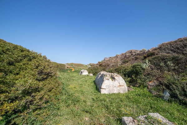
We are on the edge of the city, which is confirmed by the remains of a small round Roman amphitheatre just a few metres east of the walls, built in the mid Imperial era (figs. 5-6)
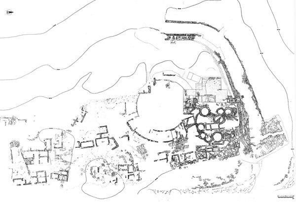
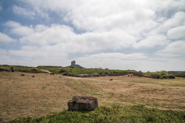
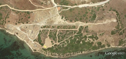
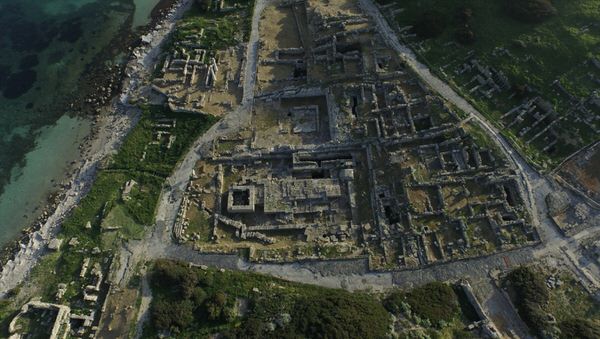
The actual town spread over the southern slopes of Su Muru Mannu and on the eastern slopes of San Giovanni, dominated by the tower of the same name, until it reached the seashore on the Gulf of Oristano (fig. 7).
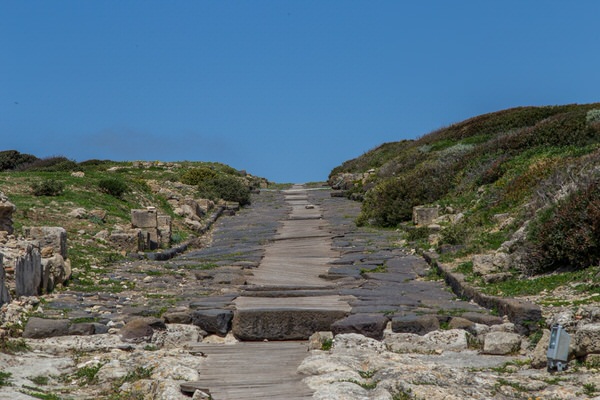
Two large parallel roads, paved in basalt and run through by a central sewer, run north-south on the southern slope of the Su Muru Mannu hill, separating three long blocks that have still to be excavated.
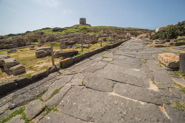
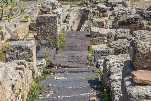
Further south, the southern sector of the inhabited area is split into large quarters by wide, paved roads, with small, narrow alleys leading off them, also paved and with sewers, that served the houses in the quarter (figs. 8-12).
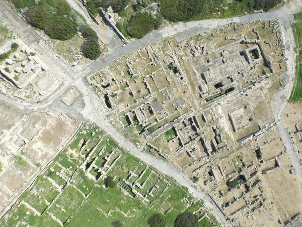
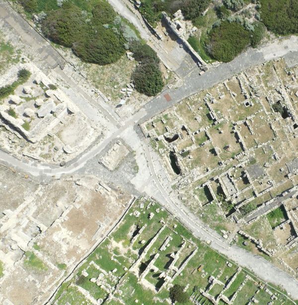
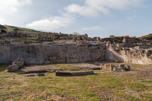
In the northwest part of the central quarter, four roads cross, forming a triangular square in the middle where a small building stood that has now been lost; the castellum aquae looks on to the square that distributes the water via a public fountain (figs 13-14)
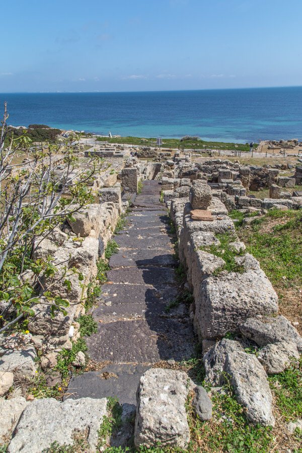
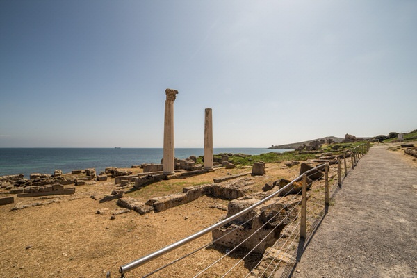
The public area of the city lies in the urban area overlooking the Gulf of Oristano, crossed by a road parallel to the coast (Fig. 15).
There is a sacred building on the western side of this area. The Punic temple of semi-columns once stood here, which in Roman times was covered by flooring that a new sacellum was built on. A large space cut into the rock was the home of the so-called “Semitic type temple” comprising two small buildings and a mosaic-covered corridor, that can be dated between the 2nd and 3rd century A.D. (fig. 16).
On the eastern side of the road there are two thermal baths, Thermal baths nr. 1 and the Convento Vecchio Thermal Baths; there is a building of unknown purpose in the space between the two thermal baths, perhaps a place of worship, with a row of
columns of which two columns have been rebuilt (fig. 17).
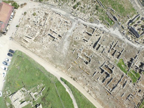
The remaining urban area is mostly taken up by houses, built by making terraces on the strongly sloping land. Small houses with one or two rooms, often with a gallery, stand next to each other without a precise technique or layout, having in common only the arrangement down a slope and having to look down onto the roads that led to them (figs. 18-19)
The importance of Tharros in Roman times was very high. Its geographical position made it a crucial hub for traffic from the Iberian peninsula towards Ostia, the port of Rome, and therefore a mandatory passing point for many goods.
We can see this in the shipwrecks found in the sea close to the western coasts, one of which contained hundreds of lead ingots from Spanish mines heading for Rome.
Tharros was not just an importation and redistribution centre towards Rome and the inland area for the goods that arrived there. It was also a production area, for example, as seen by the location of the Memmii pottery laboratories, that made oil lamps used throughout the island.
With the arrival of the Vandals, in the 5th century A.D., the urban fabric tended to break down and spread out, with the creation of centres that were both for housing and production, and this trend continued in the Byzantine era too.
Bibliografia
- P. BERNARDINI ET ALII, Tharros: indagini nell’area dell’anfiteatro romano, in The Journal of Fasti on line (www.fastionline.org/docs/FOLDER-it-2014-313.pdf)
- C. DEL VAIS, P. MATTAZZI, A. MEZZOLANI, Tharros XXI-XXII. Saggio di scavo nei quadrati B2.7-8, C2.7-8: la cisterna ad ovest del cardo, in Rivista di Studi Fenici XXIII (supplemento), 1995, pp. 133-152.
- C. DEL VAIS ET ALII, Tharros: saggio di scavo sul cardo maximus, in OCNUS. Quaderni della Scuola di Specializzazione in Archeologia, III, 1995, pp. 193-201
- A. R. GHIOTTO, L’architettura romana nelle città della Sardegna, Roma 2004
- A.M. GIUNTELLA, Materiali per la forma urbis di Tharros tardo-romana e altomedievale, in P.G. SPANU (ed.), Materiali per una topografia urbana. Status quaestionis e nuove acquisizioni, Oristano 1995, pp. 117-144
- M. MARANO, L’abitato punico romano di Tharros (Cabras-OR): i dati di archivio, in A.C. FARISELLI (ed.), Da Tharros a Bitia. Nuove prospettive della ricerca archeologica, Bologna 2013, pp. 75-94.
- A. MASTINO (ed.), Storia della Sardegna antica, Nuoro 2005, pp. 259-266.
- C. MAZZUCATO, A. MEZZOLANI, A. MORIGI, Infrastrutture idriche a Tharros: note sul sistema fognario, in E. ACQUARO ET ALII (edd.), Tharros Nomen, La Spezia 1999, pp. 117-133.
- A. MEZZOLANI, L’approvvigionamento idrico a Tharros: note preliminari, in E. ACQUARO ET ALII (EDD.), Progetto Tharros, Roma 1997, pp. 122-130
- D. SALVI, Le masse plumbae di Mal di Ventre, in L’Africa Romana, 9, 1992, pp. 661-672.
- G. SOTGIU, Iscrizioni latine della Sardegna. II, 1, Padova 1968.
 VR
VR